Derbyshire snow: Exact time snowfall is set to hit Derbyshire and the Peak District including Chesterfield, Buxton, Belper, Heanor, Matlock, Dronfield and Bakewell
and live on Freeview channel 276
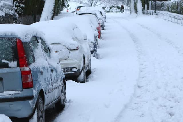
The Met Office has issued a weather warning for D erbyshire as snow and sleet are set to cause disruption across the county this Thursday, February 8 and Friday, February 9.
The temperatures will range from -1° in High Peak to 4° in Chesterfield. The Met Office predicts that some places might see up to 2cm snow at lower-levels, 2-5cm on ground above 200m, and perhaps as much as 10-20cm above 400m.
Advertisement
Hide AdAdvertisement
Hide AdBelow is a full weather forecast for Thursday and Friday including the exact time when snow is forecast to fall, according to the Met Office.

Chesterfield
Thursday, February 8
12 am – cloudy
3 am – cloudy
6 am – 60% chance of snow and sleet
9 am – 70% chance of snow and sleet
12 pm – 70% chances of snow and sleet
3 pm – 70% chance of snow
6 pm – 70% chance of snow
9 pm – 60% chance of snow and sleet
Friday, February 9
12 am – 60% chance of snow and sleet
3 am – 60% chance of snow and sleet
6 am – 60% chance of snow and sleet
9 am – 60% chance of rain
12 pm – 50% chance of rain
3 pm – 50% chance of rain
6 pm – 50% chance of rain
9 pm – 20% chance of rain
Dronfield
Thursday, February 8
12 am – cloudy
3 am – cloudy
6 am – 60% chance of snow
9 am – 80% chance of heavy snow
12 pm – 90% chance of heavy snow
3 pm – 80% chance of heavy snow
6 pm – 70% chance of snow
9 pm – 60% chance of snow
Friday, February 9
12 am – 70% chance of snow
3 am – 80% chance of heavy snow
6 am – 60% chance of snow
9 am – 60% chance of snow
12 pm – cloudy
3 pm – cloudy
6 pm – cloudy
9 pm – cloudy
Thursday, February 8
12 am – cloudy
3 am – cloudy
6 am – 60% chance of snow and sleet
9 am – 90% chance of snow
12 pm – 90% chance of snow
3 pm – 80% chance of snow
6 pm – 80% chance of snow
9 pm – 60% chance of snow
Friday, February 9
12 am – 60% chance of snow
3 am – 80% chance of snow
6 am – 70% chance of snow
9 am – 60% chance of snow and sleet
12 pm – cloudy
3 pm – cloudy
6 pm – cloudy
9 pm – cloudy
Heanor
Thursday, February 8
12 am – cloudy
3 am – cloudy
6 am – 60% chance of snow and sleet
9 am – 90% chance of snow
12 pm – 90% chance of snow
3 pm – 80% chance of snow
6 pm – 80% chance of snow
9 pm – 60% chance of snow
Friday, February 9
12 am – 80% chance of rain
3 am – 80% chance of snow
6 am – 70% chance of snow
9 am – 60% chance of snow and sleet
12 pm – 50% chance of rain
3 pm – 50% chance of rain
6 pm – cloudy
9 pm – cloudy
Bakewell
Thursday, February 8
12 am – cloudy
3 am – cloudy
6 am – 60% chance of snow
9 am – 80% chance of snow
12 pm – 90% chance of snow
3 pm – 80% chance of snow
6 pm – 70% chance of snow
9 pm – 60% chance of snow
Friday, February 9
12 am – 70% chance of snow
3 am – 80% chance of snow
6 am – 60% chance of snow
9 am – 60% chance of snow
12 pm – cloudy
3 pm – cloudy
6 pm – cloudy
9 pm – cloudy
Matlock
Thursday, February 8
12 am – cloudy
3 am – cloudy
6 am – 60% chance of rain
9 am – 90% chance of snow
12 pm – 90% chance of snow
3 pm – 80% chance of snow
6 pm – 80% chance of snow
9 pm – 60% chance of snow
Friday, February 9
12 am – 60% chance of snow
3 am – 60% chance of snow and hail
6 am – 60% chance of snow and hail
9 am – 60% chance of rain
12 pm – 60% chance of rain
3 pm – cloudy
6 pm – cloudy
9 pm – cloudy
Thursday, February 8
12 am – cloudy
3 am – cloudy
6 am – 60% chance of snow
9 am – 80% chance of snow
12 pm – 90% chance of snow
3 pm – 80% chance of snow
6 pm – 80% chance of snow
9 pm – 80% chance of snow
Friday, February 9
12 am – 80% chance of snow
3 am – 80% chance of snow
6 am – 80% chance of snow
9 am – 80% chance of snow
12 pm – 60% chance of snow
3 pm – 60% chance of snow
6 pm – 50% chance of snow
9 pm – cloudy